
Precision Groundwater Detection Technology
Drilling a deep borehole blind without subsurface geophysical data involves massive financial risk. Geological formations across Pakistan feature intricate transitions between impermeable clay barriers, fractured limestone, boulders, and saline coastal intrusion. The Electrical Resistivity Survey (ERS) provides a scientific window into the ground before mobilizing expensive drilling equipment.
By measuring variations in subsurface electrical conductivity, our geophysicists differentiate saturated sand and gravel aquifers from dry bedrock and brackish saline water. Whether planning an industrial tube well in Port Qasim, a farm well in interior Sindh, or a commercial supply in Balochistan, an ERS ensures drilling takes place at the exact coordinate offering maximum water volume and highest water quality.
What Is Included in KTP ERS Investigations
Our geophysical exploration services combine high-precision multi-electrode survey equipment with advanced 2D and 3D computer inversion modeling. Client deliverables include:
Standard Geophysical Deliverables
- Field reconnaissance & layout planning: Establishing optimum survey traverse orientation to cut across suspected geological faults and strike lines.
- 1D Vertical Electrical Soundings (VES): Schlumberger array testing to establish detailed vertical stratigraphy and target aquifer depth directly beneath proposed well coordinates.
- 2D Electrical Resistivity Tomography (ERT): Multi-electrode continuous profiling mapping lateral continuity, fracture systems, and salinity transitions.
- Raw apparent resistivity curves: Digitally logged voltage and current measurements gathered using high-sensitivity geophysical meters.
- Computer-inverted resistivity models: True resistivity pseudo-sections processed using robust inversion software to generate colored geological cross-sections.
- Hydrogeological interpretation: Clear identification of water table depth, aquifer thickness, bedrock contact, and estimated yield potential.
- Signed drilling recommendation report: Specific borehole depth recommendations, screen placement intervals, and GPS drilling coordinates.
5-Step Geophysical Survey Workflow
Our field engineers execute surveys systematically to prevent surface electrical noise and ensure repeatable data accuracy:
Site Inspection & Layout
Our team assesses site dimensions and stakes straight electrode survey lines away from underground metallic pipelines or power lines.
Electrode Planting & Coupling
Steel or copper electrodes are driven into the ground at calibrated intervals. Contact resistance is verified with saline wetting where dry soil exists.
Controlled Current Injection
Direct electrical current is injected through outer electrodes (A and B) while resultant potential differences are recorded across inner electrodes (M and N).
Computer Inversion Analysis
Raw data is imported into 2D/3D inversion software to eliminate topographic effects and calculate true resistivity layer depths.
Comprehensive Report & Consultation
We present our hydrogeological findings, mapping freshwater zones, estimating static water levels, and specifying exact drilling depths.
Survey Configuration & Depth Capabilities
The table below summarizes standard survey arrays and depth reach achievable across common Pakistani geological strata:
| Survey Array Method | Typical Investigation Depth | Primary Objective | Required Surface Spread | Timeline |
|---|---|---|---|---|
| 1D VES (Schlumberger) | 150 ft to 1,000+ ft | Target borehole depth & sweet/saline boundary | 3x target depth | 1 - 2 Days |
| 1D VES (Wenner) | 50 ft to 400 ft | Shallow aquifer & civil soil strata resistivity | 3x target depth | 1 Day |
| 2D ERT Imaging | 100 ft to 600 ft | Lateral fault mapping & bedrock profiling | Continuous cable roll | 2 - 3 Days |
| Regional Hydrological Mapping | Multiple points across site | Industrial park or agricultural estate siting | Grid layout | 3 - 5 Days |
Cost Factors for Electrical Resistivity Surveys
Pricing for an ERS investigation is determined by operational requirements rather than generic estimates. Key pricing factors include:
Deeper electrical profiling requires longer electrode spread lines, higher voltage transmitters, and extended data logging time.
Multi-point 1D sounding grids or continuous 2D tomography profiles provide complete acreage mapping across large commercial estates.
Clear straight-line corridors allow fast testing, while rocky outcrops or urban utilities require special electrode positioning.
Field surveys outside greater Karachi throughout Sindh and Balochistan incorporate crew deployment and logistics.
Field Investigation Case Summary
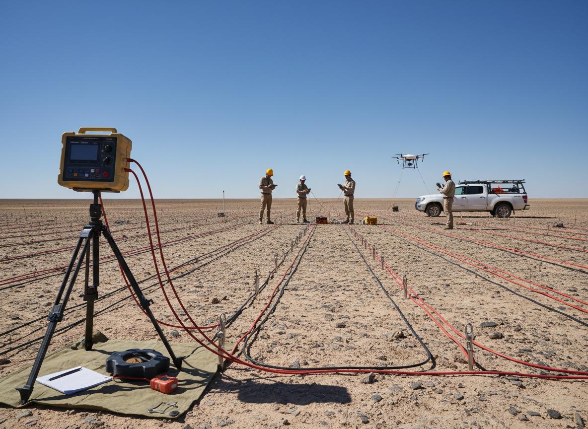
Aquifer Mapping & Salinity Demarcation
Investigation Depth: 650 feet VES profiling
Outcome: Detected a 40-foot thick freshwater gravel aquifer layer at 420 feet depth, successfully bypassing upper brackish groundwater lenses.


